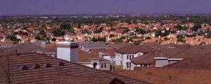
Antelope Valley Information
The two largest incorporated cities in the Antelope Valley are Palmdale and Lancaster. Other incorporated cities include California City, Ridgecrest and Tehachapi. The remaining communities are considered unincorporated communities governed by their respective counties, either Los Angeles or Kern.
Greater Antelope Valley Region
Square Miles: 2,200
Population: 475,000
Population Forecast: 780,504 by 2020
Lancaster
Elevation: 2,450 ft.
Square Miles: 94.2
Population: 168,049
(118,718 in 2000 Census)
Meetings: Lancaster City Council, 44933 Fern Ave., second and fourth Tuesdays, 7 p.m. Lancaster Redevelopment Agency, second and fourth Tuesdays, 6 p.m. Planning Commission, third Monday, 7 p.m. Antelope Valley Chambers of Commerce (Lancaster and Rosamond), monthly business luncheons, 11:30 a.m.
Information: 661/723-6000
Lancaster is a bustling community with a growing number of industries, affordable housing, employment, schools, recreational opportunities and excellent smog-free weather 300 days or more a year. It is the ninth-largest city in Los Angeles County and the third-fastest growing. Los Angeles is a short one-and-a-half hour drive on Highway 14. Bakersfield, San Bernardino, and coastal communities are easy commutes, too.
Antelope Valley Homes
In 1876, the Southern Pacific railroad made Lancaster one of its stops. That milestone sparked growth in the Antelope Valley. Most of the early settlers in Lancaster were farmers who established homesteads in outlying areas. Their main shopping was done in Old Lancaster, which today is located on East Lancaster Boulevard near Cedar Avenue. There, you will see the historic Western Hotel (first built in the 1800s) and a number of original buildings dating back to the 1930s. Among those are old county buildings and a post office.
Thanks to the Lancaster Old Town Site Board (LOTS), “The Boulevard,” as it is fondly called by old-timers, has been renewed and well maintained. Trees and antique light standards line both sides of the street, which give the area a special ambience.
The city encourages citizens to get involved with the formation of its new Downtown Lancaster Specific Plan, which will revitalize the downtown the district. Up-to-date information about progress and citizen-involvement opportunities can be obtained by calling 661/723-6132 or visiting www.celebratedowntown.org.
The heart of the city is home to the 758-seat Lancaster Performing Arts Center and Los Angeles County’s largest regional library, which services nearly 100,000 cardholders. Downtown Lancaster has become the major financial center of the Antelope Valley, the site of a new $25 million sheriff’s station and a state-of-the-art fire station.
Lancaster’s population totals 133,703, according to the California Department of Finance. The city’s long list of move-in incentives for new businesses and available commercial land for expansion make it an attractive place for Los Angeles-area entrepreneurs to grow their businesses.
Lancaster also is home to Clear Channel Stadium (formerly The Hangar), the city’s 6,850-seat municipal baseball stadium and home to the Arizona Diamondback-affiliated Lancaster JetHawks baseball team. The stadium opened in 1996. When not attracting sellout crowds for baseball, the facility hosts a variety of special events such as concerts, fireworks festivities, car shows and amateur athletics.
One of the major attractions in Lancaster is the annual Antelope Valley Fair, which has relocated to new quarters on 135 acres north of Avenue H and west of the Antelope Valley Freeway. Groundbreaking was held in 1999. New facilities include two exhibit halls, a Watch & Wager building, an RV park with restrooms and showers, a grandstand with 7,000 seats, a show arena and other assorted structures.
Palmdale
Elevation: 2,655 ft.
Square Miles: 105
Population: 136,734
(116,670 in 2000 Census)
Meetings: Palmdale City Council, 38300 Sierra Hwy., Suite B, second Wednesday of month, 6 p.m. Planning Commission, first and third Thursdays, 7 p.m. Palmdale Chamber of Commerce hosts monthly (third Wednesday) business luncheons at 11:30 a.m.
Information: 661/267-5100.
The Palmdale economy is booming, experiencing solid growth that is reflected in rising housing values and increased city revenue. Inflation still registers in low single digits. The city continues to be one of the fastest-growing cities in the nation. To give this growth some perspective, from April 1, 1990 to April 1, 2000, Palmdale mushroomed by 76.4 percent, according to the 2000 U.S. Census. Employment is up, crime statistics are down, and home sales are brisk. Indeed, like Lancaster and other neighboring communities, home values have risen dramatically as well, fueled in large part by the area’s family-friendly environment, affordability and record-low interest rates.
Covering an area of more than 100 square miles, Palmdale now has more than 143,000 residents, according to city sources. It was the first community within the Antelope Valley to incorporate as a city, doing so on Aug. 24, 1962. The city has consistently ranked in the top-10 fastest-growing cities in the nation over the last 20 years. It is the sixth largest city in Los Angeles County.
At the heart of the city is the Palmdale Cultural Center at Palmdale Boulevard and Sierra Highway. Styled in a Spanish motif, the Cultural Center has undergone a major renovation. Adjacent to the Cultural Center is the Palmdale City Library. 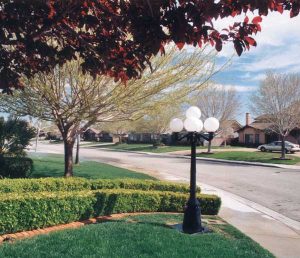
Poncitlan Square, a beautiful park fashioned after a similar one in Palmdale’s sister city, Poncitlan, Mexico, was built in 1998. A new development service building and a Palmdale Courthouse were completed in 2000 and 2001, respectively. The renovated 22-year-old Larry Chimbole Cultural Center is located in the Civic Center area and is bounded by Sierra Highway and Palmdale Boulevard. The 21,800-square-foot building features an upstairs auditorium that can accommodate 350 people in theater seating or 250 for dinner, and three meeting rooms for 40 to 50 people. These new facilities are a part of the city’s downtown revitalization plan. The city also opened a brand-new sheriff’s station in July 2006.
Palmdale is home to some of the world’s top aerospace companies, as well as a continually growing number of high-tech manufacturers. Top aerospace companies such as Lockheed Martin, Boeing and Northrop Grumman continue to have a strong presence at Air Force Plant 42 in Palmdale. Although space shuttle modification has been transferred to Florida, there’s a lot of important work going on here. Work continues on such programs as the F-35 Joint Strike Fighter, the unmanned Global Hawk reconnaissance aircraft, the B-2 stealth bomber, the X-45A unmanned combat air vehicle and the unmanned X-37 space plane.
Palmdale Regional Airport, which is owned and operated by Los Angeles World Airports (LAWA) under a joint-use agreement with the U.S. Air Force, is located on a 61-acre site on the property of Air Force Plant 42. The terminal at 41000 North St. East first opened on June 29, 1971. Since then, LAWA has acquired an additional 17,750 acres of adjacent property for the airport’s eventual development into a large commercial airport. The airport is poised to accommodate increased future air travel if and when Los Angeles International Airport (LAX) reaches capacity.
With more than 2,000 companies making Palmdale home, the city embraces an entrepreneurial spirit. Palmdale offers a wealth of leased space, spec buildings and land available for construction. Land costs in Palmdale are very attractive, often half that found in other areas of California.
Moreover, a number of key incentives can help reduce the cost of doing business in Palmdale. The city is part of the Antelope Valley Enterprise Zone and hosts its own Foreign-Trade Zone. Hiring, training and investment incentives are also available to qualified firms.
Health care has taken some major steps forward in Palmdale, which is one of the largest U.S. cities without a hospital. That unfortunate status is expected to change soon. Construction of the Palmdale Regional Medical Center began in 2005 and is expected to be completed in 2007. The 250,000-square-foot facility is being built by Universal Health Services (UHS) on 37 acres near Tierra Subida and Palmdale Boulevard. The new hospital will feature OB/GYN services, cardiac-catheterization labs, pediatrics, general medical care and a 35-bed emergency room, the latter of which will be the largest ER in the area and double the number of ER beds throughout the valley. The hospital will open with 171 beds, to be composed of 32 intensive care beds; 108 medical surgical, telemetry and pediatric beds; 25 obstetrics beds, and six neonatal intensive care beds. UHS plans to eventually add 32 more intensive care and 36 medical surgical beds, giving the hospital a total of 239 beds.
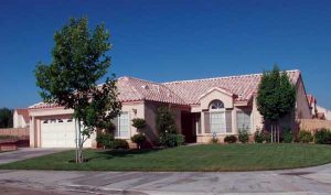
Many Homes are Being Built in the Antelope Valley…
 Filling the health-care gap until the new hospital opens is an urgent-care clinic that opened in mid-2002 as part of the South Valley Medical Center, which was built by Antelope Valley Hospital. And, in March 2003, Kaiser Permanente opened a new medical office building in Palmdale. Filling the health-care gap until the new hospital opens is an urgent-care clinic that opened in mid-2002 as part of the South Valley Medical Center, which was built by Antelope Valley Hospital. And, in March 2003, Kaiser Permanente opened a new medical office building in Palmdale.
New recreational facilities are a big part of the city’s vision for the future. March 25, 2004, marked the beginning of construction of the “Vision for the Future” park projects. The $42 million project – funded in part by a $31.4 million bond assessment passed by Palmdale residents – paid for a new recreation center, swimming pool and water park on the east side of Palmdale and a new recreation center, swimming pool, amphitheater and softball complex on the west side. The city’s DryTown Water Park & Mining Co. opened at Palmdale Oasis Park in 2006. It features a six-acre Old West mining town-themed aquatic park with a 925-foot lazy river; a 35-foot tower with three water slides and a splash pool; 6,000-square-foot children’s water playground; a food and beverage snack bar with patio area; a merchandise store; covered picnic area; large grassy area for group outings, and a community room. The budget for Palmdale Oasis Park, which includes DryTown Water Park, was $27.6 million. In addition to the new water park, this site also includes the Palmdale Oasis Park Recreation Center, a 4.5-acre landscaped area designed for community events and a 12-acre flood retention basin that will be landscaped to accommodate soccer and football.
And, a competition-size pool opened at Marie Kerr Park in 2006. The city oversaw a 40-acre expansion of Marie Kerr Park at 30th Street West and Rancho Vista Boulevard (Avenue P). In 2005 the park received a stunning outdoor amphitheater that is the site of summer concerts, movies and other events.
The city also has undertaken a traffic signal-installation program and other transportation projects. The city also has committed more than $10 million to improve some of its busiest surface streets. The city completed its Avenue S Corridor Improvement Project in June 2006.
Another major project is the $14 million Palmdale Transportation Center, which opened in 2005. The facility near Sierra Highway and 6th Street East just south of Technology Drive will be the transportation hub of the Antelope Valley. Site improvements include a Spanish-style station terminal, plaza area, Metrolink station platform, parking lot and 45-foot clock tower. The center features a Metrolink commuter rail station, bus service, van-pool and park-n-ride services with future provisions for high-speed rail and airport service. Bicycle and pedestrian paths plus landscaping complement the new center.
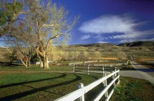
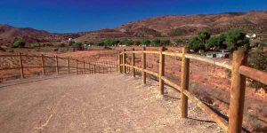
Buy a Ranch and Raise Horses

Also in the works is a remodel of the Antelope Valley Mall, and the opening of a new 16-screen cinema complex at the Antelope Valley Mall.
Surrounding Communities
Acton
Elevation: 2,700 ft.
Square Miles: 77
Population: 9,175
Meetings: The Acton Town Council meets on the first and third Mondays (7:30 p.m.) at the Acton Community Club, 3742 Nickels St. The Acton Chamber of Commerce, located at 32039 N. Crown Valley Road, meets regularly at various locations. Information: 661/269-5785.
Acton was founded in 1887 by gold miners working in the nearby Red Rover Mine. The unincorporated community was named after Acton, Mass. by one of the miners. Henry Gage, who served as California governor from 1899 to 1903, owned the Red Rover Mine and unsuccessfully tried to relocate the state capitol to Acton. Today, Red Rover Mine Road, a familiar exit off Highway 14, is the only vestige of those “golden days” of yesterday.
Acton is known as “The Gateway to the Antelope Valley.” There is an element of the Old West apparent when you drive through this rural community. Gold, copper and titanium ore were mined near Acton in the 1800s. In those early days, a large copper deposit was mined at the Mount Emma Mine near Parker Mountain.
The rugged Sierra Pelona Mountains to the north and the San Gabriel Mountains to the south ring the Acton area. Located seven miles south of Palmdale, Acton is commonly referred to by locals as the Beverly Hills of the Antelope Valley, in large part because many of its homes are expensive mansion and ranch-style properties on large lots. On the valley floor, horse corrals sandwiched between custom and semi-custom homes create a remarkable equestrian panorama.
Acton has its own Metrolink train station, which is themed in an Old West style and frequently used in movies, TV shows and commercials. Riders on the Metrolink trains can often spot large wild animals grazing in the fields of the Shambala Preserve, operated by actress Tippi Hedren.
On Third Street in downtown Acton there is a western-style saloon called The 49er, which was built in 1889. The saloon, which is still open, has had a cafe added to it.
Agua Dulce
Elevation: 2,400 to 4,000 ft.
Square Miles: 25
Population: 4,000-plus
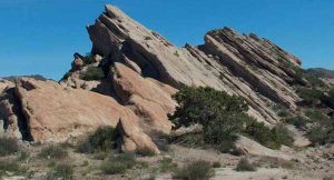
If you like movie sets, stuntmen, horses and rugged, rocky landscapes, Agua Dulce is for you. The Agua Dulce area, about 25 miles southwest of Palmdale and 44 miles north of Los Angeles, is a favorite filming location for commercials and movies because of its reddish, towering rock formations and canyons. Moviemakers love the authentic-looking backgrounds that the monolithic Vasquez Rocks create for westerns and science fiction films. Vasquez Rocks is the community’s most recognizable landmark.
Vasquez Rocks offers unusual rock formations….
The hillsides of Agua Dulce are dotted with million-dollar mansions where Los Angeles commuters, stuntmen and Hollywood executives live side-by-side. Residents there appreciate the country style, picturesque environment and easy commute to jobs in the city.
Agua Dulce, which means “sweet water” in Spanish, was first inhabited by the Tataviam Indians. The Vasquez Rocks formations were a favorite shelter for the tribe.
Between 1857 and 1875, Vasquez Rocks served as a hiding place for the famous horse thief and bank robber, Tiburcio Vasquez. The California State Legislature put a $15,000 bounty on the infamous bandit’s head, and he was finally captured on May 13, 1874, and hanged on March 19, 1875. The area’s high school now bears his name.
In the 1880s, farmers created the “Soledad Township,” which was Agua Dulce’s original name. Today, street names such as Wagon Wheel Road, Yucca Hills, Zorro Way, Coyote Trail and Durango Lane remind us of the rich Old West heritage of the area.
If you are a pilot, you will appreciate the 190-acre Agua Dulce Airpark. The fraternity of flyers is very organized and has many activities for private pilots.
Boron
Elevation: 2,499 ft
Square Miles: 13.9
Population: 2,025 (U.S. Census, 2000)
Meetings: Boron Chamber of Commerce, second and fourth Monday.
Boron is a small community, and people here like it that way. U.S. Borax, one of Boron’s two major employers, operates California’s largest mine here and is one of the state’s oldest companies. The Air Force is the second largest employer and provides jobs for most of the working people in Boron. It has been like that for 30 or 40 years.
While there is not a lot of growth in Boron, there is a concern for preserving the history of the area. In the center of town, on Twenty Mule Team Road, you will find the Twenty Mule Team Museum and the Vernon P. Saxon Jr. Memorial Aerospace Museum. Each contains historical items, such as mining displays, railroad memorabilia and jet fighters from former wars.
California City
Elevation: 2,437 ft.
Square Miles: 203.6
Population: 11,504
(8,385 in 2000 Census)
Meetings: California City’s City Council meets on the first and third Tuesday of the month. City Hall is located at 21000 Hacienda Blvd.
Information: 760/373-8661
As one of the fastest-growing regions in Southern California, California City has been undergoing significant change. It has an evolving and diverse business base. Recent developments include Ellison Plaza, which addresses the city’s need for shopping, entertainment, dining and lodging. Microtel Inns & Suites, a 103-unit hotel, opened in 2006. Developed by homebuilder Michael Ellison, the commercial center is designed to help California City attract retailers, the most important of which is a major grocery store. Ellison builds homes ranging in size from 1,525 to 6,250 square feet, with prices starting in the low $200,000s.
Other developments include a $50 million Hyundai Kia Motor Co. test track and facility, which opened in 2004 and created new jobs for the area. The facility is expected to eventually employ about 100 people. The car company chose California City primarily because of its dry, warm and sunny desert climate, which is ideal for stress-testing new cars and improving automotive design.
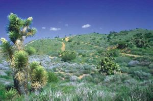
 The Antelope Valley Offers many outdoor activities… A new high school and elementary school are under construction, more than $30 million in new construction and home-building permits have been issued, and a new gated golf course community was in development.
The city also is home to the California City Correctional Center, a 2,305-bed prison that employs 551 people; a McDonald’s restaurant, and a Rite Aid store. A 40-acre industrial park near the California City Municipal Airport is in the works.
More people are moving into California City because they have discovered what residents here have enjoyed for a long time. Home and land prices are very affordable. Not only that, you can add excellent weather, clean air, good schools and safe streets. While this charming little community of about 11,000 is relatively new, it has all the enhancements of larger towns – including incorporation. There is easy shopping, a wonderful Central Park and a professionally designed PGA 18-hole and par-3 golf course.
Developer N.K. “Nat” Mendelsohn had a dream of building a large master-planned leisure community in the area as early as 1956. He envisioned converting M&R Ranch, a 208-square-mile stretch of land northeast of Mojave, into a residential area that would house up to 1 million people by the turn of the century. Mendelsohn’s planned community was premature, but he created a lot of hope and enduring loyalty in California City’s residents. Like Mendelsohn, many of them still think their town is a “sleeper.”
California City also is a favorite destination for off-road enthusiasts. From Cal City dirt bikers and ATVers fan out across the expansive desert and ride into the Red Rock area and old mining towns such as Randsburg, population 77.
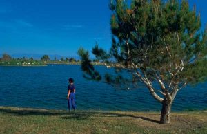
Lake Los Angeles
Elevation: 2,664 ft.
Square Miles: 282
Population: Approximately 13,000
(11,523 in 2000 Census)
Meetings: Lake Los Angeles Rural Town Council, monthly at Vista San Gabriel Elementary School, third Wednesday, 7 p.m.
 Antelope Valley Ranches Lake Los Angeles is located about 10 miles east of Lancaster off Avenue J. The town is surrounded by rolling hills and large, rocky buttes. Mother Nature has sprinkled a generous helping of Joshua trees into the mix to make the landscape even more interesting.
The name Lake Los Angeles may be misleading. “Los Angeles Buttes” would be a more descriptive name for this community of 12,800 people.
Before the 1960s, Lake Los Angeles did not exist. The only people who lived in the area were a few ranch families. Then, in 1967, a group of developers bought a 4,000-acre parcel of land there. They subdivided it into 4,465 lots and created a man-made lake to help spur home sales.
People all over the world bought the lots, but by 1971 only 14 houses had been built. After that, home building fizzled in Lake L.A. until the early 1980s. The town came alive again because many people were back working in the aerospace industry. However, Lake L.A.’s period of prosperity was short-lived. A few years later, the economy softened and development slowed.
The water supply for the lake was shut off in 1981 and the lake dried up. People tried to restore the water, but failed. Eventually, the lake was converted into a community park.
As in other parts of the Antelope Valley, the area is undergoing growth. Movie producers have found Lake Los Angeles a wonderful spot for location shooting. One of the favorite places for filming is Club Ed on 150th Street East, just south of Avenue K. Another location is a fairly new “Four Aces” set on Avenue Q and 145th Street East.
The Antelope Valley Indian Museum is the biggest attraction for tourists in Lake Los Angeles. In addition, Saddleback Butte State Park and the Alpine Butte Wildlife Preserve attract outdoor enthusiasts.
Lake Elizabeth/Lake Hughes
Elevation: 3,200 ft.
Square Miles: 139
Population: Approximately 3,000
Meetings: The Lakes Town Council, monthly, first Saturday, 8:30 a.m., in the Lake Hughes Community Center.
Picture this: Green rolling hills, picturesque farmhouses and barns, winding fences and two beautiful blue lakes. Only two miles apart, the lakes cover about 235 acres of water and are a favorite haven for swimmers, fishermen and picnickers.
The 3,000 or so residents who live here call their home “The Lakes” because it’s easier than saying Lake Elizabeth and Lake Hughes. A true delight for those who love a pastoral setting, “The Lakes” is just 20 miles west of Palmdale.
In the late 1800s, resident farmers grew hay and grapes in “The Lakes” area. By the 1920s, resort development had begun. The first housing development came in 1922. In the years that followed, the area evolved slowly to what it is today.
You cannot fish or swim in half of Elizabeth Lake because it is privately owned. The other half is owned by the U.S. Forest Service, and the public is invited. You cannot water ski on the lake, but powerboats are permitted, provided engines are no more powerful than 10 h.p.
To access Lake Hughes, you have to enter through a resort there. The resort offers developed campsites, with all of the necessary conveniences, including hot showers.
Leona Valley
Elevation: 2,900 ft.
Population: Approximately 2,200
Leona Valley, a small, unincorporated community of about 2,200 people, is one of the Antelope Valley’s best-kept secrets. Located 12 miles southwest of Palmdale, the desert landscape changes to green farmland. Instead of Joshua trees, you will find rolling hills, cherry orchards and horse barns. It is known primarily for its agriculture, which is highlighted during the annual Leona Valley Cherry Festival.
This valley is a long narrow valley separated from the Antelope Valley by Ritter Ridge, along the San Andreas Fault. The valley is about a mile wide and 25 miles long. Around Leona Valley, large homesteads were sold and sub-divided by developers. What you see now are large, custom houses with lots of acreage.
Littlerock
Elevation: 3,000 ft.
Square Miles: 1.5
Population: 1,402 (2000 Census CDP area)
Meetings: Littlerock Town Council, monthly, second Thursday, 7 p.m., Alpine Grange Hall, 87th Street East and Avenue T-8.
As you drive through Littlerock on Highway 138, fruit stands are everywhere. There are great fresh-off-the-tree bargains. If you are a do-it-yourselfer, you can pick your own at the U-Pick orchards. Either way, people return every year to buy fruit or pick it. At last count, there were more than 700 acres of deciduous fruit trees in this Rockwell-esque community.
If you are an antique enthusiast, Littlerock should whet your appetite. There are numerous little antique shops lining the main street. “Oldies but Goodies” can be bought in Littlerock – well below prices in other areas.
In 1870, Littlerock was a scheduled stop for the Butterfield Stage Coach Line. Nowadays, it has an estimated population of 12,003, which has tripled since 1991 when only 4,000 residents lived here.
People who want acreage and horses love Littlerock because large lots are inexpensive and zoning allows animals.
There are not a lot of sidewalks because residents like the rural influence. It is better for riding horses through town.
Littlerock’s Everett Martin Park, located at 92nd Street East and Avenue U, features a summer swimming pool, basketball court, playground areas, and picnic tables and barbecues.
Mojave
Elevation: 2,787 ft.
Square Miles: 75
Population: 3,751 (3,836 in 2000 Census)
Meetings: Mojave Town Council, monthly, third Wednesday, 7 p.m., in the Mojave Veterans Building. Mojave Chamber of Commerce, monthly, fourth Thursday 7:30 a.m.
At the junction of Highways 14 and 58, in East Kern County, Mojave is a welcome oasis for tired travelers, truckers and commuters. Fast-food restaurants and service stations line both sides of the highway. It is located at the northwest corner of the Mojave Desert.
Mojave is home of the Mojave Spaceport, America’s first inland spaceport and location of the first private space flight. The spaceport drew international attention when SpaceShipOne took off from here on June 21, 2004. SpaceShipOne was the first privately funded, built and operated manned craft to reach space. It was built by Burt Rutan’s Scaled Composites, which was awarded the $10 million Ansari X Prize after the craft repeated the feat twice within a two-week window in October 2004. After winning the prize, Rutan remarked that the isolation of Mojave fosters such invention. “Innovation is what we do here because there’s not much else to do in Mojave,” he said. Rutan, also known as the designer and builder of the famous Voyager aircraft that flew around the world non-stop with his brother Dick at the controls, exemplifies the strong aerospace spirit that thrives here.
Mojave has experienced other aviation milestones, as well. As home to Edwards Air Force Base, it was the site of the first supersonic flight and the first landing of the space shuttle. As motorists who drive through Mojave can attest, the Mojave Airport also serves as a vast storage yard for hundreds of commercial airliners, which are flown and parked here because of its aviation-friendly climate.
With a population of just under 4,000, Mojave is small but probably the most important transportation center in the High Desert. According to Caltrans estimates, more than 30,000 vehicles pass through the main intersection of Highways 58 and 14 every day. That total will increase to 61,600 vehicles by the year 2020 – just during weekdays.
Since 1876, Mojave has continued to be an important hub of transportation activity. In its early days, it was a freight stop for 20-mule team freight wagons hauling borax from Death Valley to the railroad. Then, Mojave experienced a sudden boom period.
Gold was discovered in 1876 and continued to support the town’s economy, in a boom-to-bust fashion, until the beginning of World War II. At that time, gold prices fell, and mining operations closed.
Luckily, the Marines built an auxiliary pilot training base in Mojave during the war years, which bolstered the dwindling economy. In addition, the Army’s bombing range nearby and Muroc Army Air Field, 18 miles east of town, brought in more money. In 1958, the Marine base was turned over to Kern County. Then, in 1972, the base became the East Kern Airport District and grew into a large aviation/aerospace industrial complex. With that growth came a name change. The Mojave Airport District, as it is called today, employs people from all parts of the Antelope Valley.
As you drive out of Mojave on your way to Bakersfield, you will see rows and rows of wind-machine propellers flashing rhythmically in the sun. They represent another large industry for Mojave – wind power. While this relatively new enterprise does not share the rich history of mining and transportation in the area, it does bring employment and income to its residents.
Pearblossom
Elevation: 2,570 ft.
Square Miles: 40
Population: 2,435
Always make sure you have a full tank of gas before driving out into the desert. Pearblossom is a last-chance fill-up spot if you are traveling between Palmdale and San Bernardino on Highway 138. If you want a snack, you can get that, too, in this delightfully small “wide place in the road.”
If you drive fast through Pearblossom, you will have to be alert, or you may miss a large part of the town. Pearblossom is located 15 miles southeast of Palmdale on Pearblossom Highway. Its boundaries cover a 40-square-mile area, from 106th Street East to 155th Street East, then north to Avenue S and south to Fort Tejon.
About 2,400 people live in Pearblossom. Founded in 1928, Pearblossom was originally called Mertel. It was a place where people came to retire. That changed when people started moving in from Los Angeles.
There are about 20 to 25 businesses in Pearblossom and just one elementary school. The hot spot in town is the Town & Country Market, where residents shop and meet friends. Indeed, there is a unique friendliness inside the store that passes through to the rest of the town.
Quartz Hill
Elevation: 2,405 ft.
Square Miles 4.5
Population: Approximately 25,000
Meetings: Quartz Hill Town Council, monthly, third Tuesday, 6:30 p.m. Quartz Hill Chamber of Commerce hosts monthly luncheons at 11:30 a.m.
Quartz Hill is exactly that – a hill filled with quartz. This community of about 25,000 people takes its name from a small hill at 45th Street and Avenue M that contains a large amount of silicone dioxide, or quartz. Primarily a residential area, Quartz Hill covers an estimated 4.5 square miles.
Residents pride themselves in the rustic qualities of the town, where zoning ordinances still allow horses. In addition to the equestrian properties, there are large developments of custom and semi-custom homes that have beautiful views from half-acre and full-acre hillside lots.
 Pearblossom CA Ranches. Fishing in the California Aqueduct nearby and horseback riding on the many horse trails offer leisure-time activities for residents.
Quartz Hill was once a top almond-producing area for the United States. In the 1950s, there were more than 2,000 acres of almond orchards there. Home developments were added over the years, and the orchards gradually disappeared. The 50-year-old Almond Blossom Festival and Parade, held annually in the spring, is all that is left of the almond era.
Rosamond
Elevation: 2,415 ft.
Population: Approximately 16,000 (14,349 in 2000 Census)
Rosamond, located 15 miles west of Edwards Air Force Base and 20 miles north of Palmdale, is an unincorporated community in southeastern Kern County. With an estimated population of nearly 16,000 people, Rosamond is one of the fastest-growing communities in the Antelope Valley. Home prices are lower in Rosamond than they are in Palmdale and Lancaster, and the commute to Los Angeles is not that much farther.
Although Rosamond demonstrates a robust growth profile, the community offers a slower pace than Lancaster or Palmdale and is a wonderful place to raise children. The downtown area remains small because new shopping centers have been built in the outlying areas close to housing developments.
Rosamond was originally established in 1877 as a community owned by Sothern Pacific Railroad. It was named ‘Rosamond’ after the daughter of one of the railroad company’s officials. Two historical influences may be seen in Rosamond – gold mining and the air base. Gold, which was discovered in Rosamond in 1894, accounted for the majority of Rosamond’s early economic growth. The old Tropico Gold Mine, originally called the Lida Mine and still standing on a Rosamond hillside, employed many of the town’s residents. Meanwhile, Muroc Army Air Corps Base, as it was called in the ‘40s and early ‘50s, provided additional income for the community. Renamed Edwards Air Force Base in 1956, the installation has become Rosamond’s largest employer and an economic mainstay for the entire Antelope Valley. Many of Rosamond’s residents commute to points south.
 Beautiful places to hike… Two of Rosamond’s main attractions – Willow Springs International Raceway and the Exotic Feline Breeding Compound – bring lots of visitors each year. Another outstanding feature is Rosamond Sky Park, an upscale housing development that offers pilots an opportunity to park their airplanes in backyard hangars. The park has runway access to Rosamond Airport.
Sun Village
Elevation: 3,000 ft.
Population: Approximately 8,200
Originally, Sun Village was an all-black development that was started after World War II by a white woman known only as Mrs. Marble. Her company was called the Sun Village Land Corp. This predominantly ethnic community is located near 90th Street East and Palmdale Boulevard.
Although Sun Village has its own chamber of commerce now, it continues to battle for its identity as a full-fledged town. There are only two visible markers showing the community’s boundaries – two signs put up by county supervisor’s office in 1993. On paper, the community’s boundaries have been defined by the Los Angeles County Water District and the Los Angeles County Assessor’s Office.
In the 1950s, Frank Zappa’s first band, “The Blackouts,” played in the Sun Village area.
A colorful woman activist named Daisy Gibson was responsible for much of Sun Village’s early progress. With a small group of spirited individuals, she fought for many of the things most people took for granted: paved roads, fire hydrants and water. Part of Gibson’s early campaigns was waged as a talk-show hostess on Palmdale’s radio station, KUTY.
On June 16, 1965, Jackie Robinson Park was dedicated after its baseball hall-of-fame namesake. With the help of L.A. County, a softball field was built, including tetherball courts and a sand play area. A large multipurpose center was also built.
 Local Post Offices Worshiping in the Antelope Valley
Church attendance is strong in the Antelope Valley. Hundreds of different faiths are represented, among them Apostolic, Baha’i, Baptist, Bible, Christian, Christian Science, Church of Jesus Christ of Latter Day Saints, Disciples of Christ, Evangelical, Islam’s, Jehovah’s Witnesses, Jewish, Islamic, Lutheran, Methodist, Pentecostal, Presbyterian, Roman Catholic, Religious Science, Science of the Mind, Seventh Day Adventist, Unitarian/ Universalist and The Vineyard.
|
